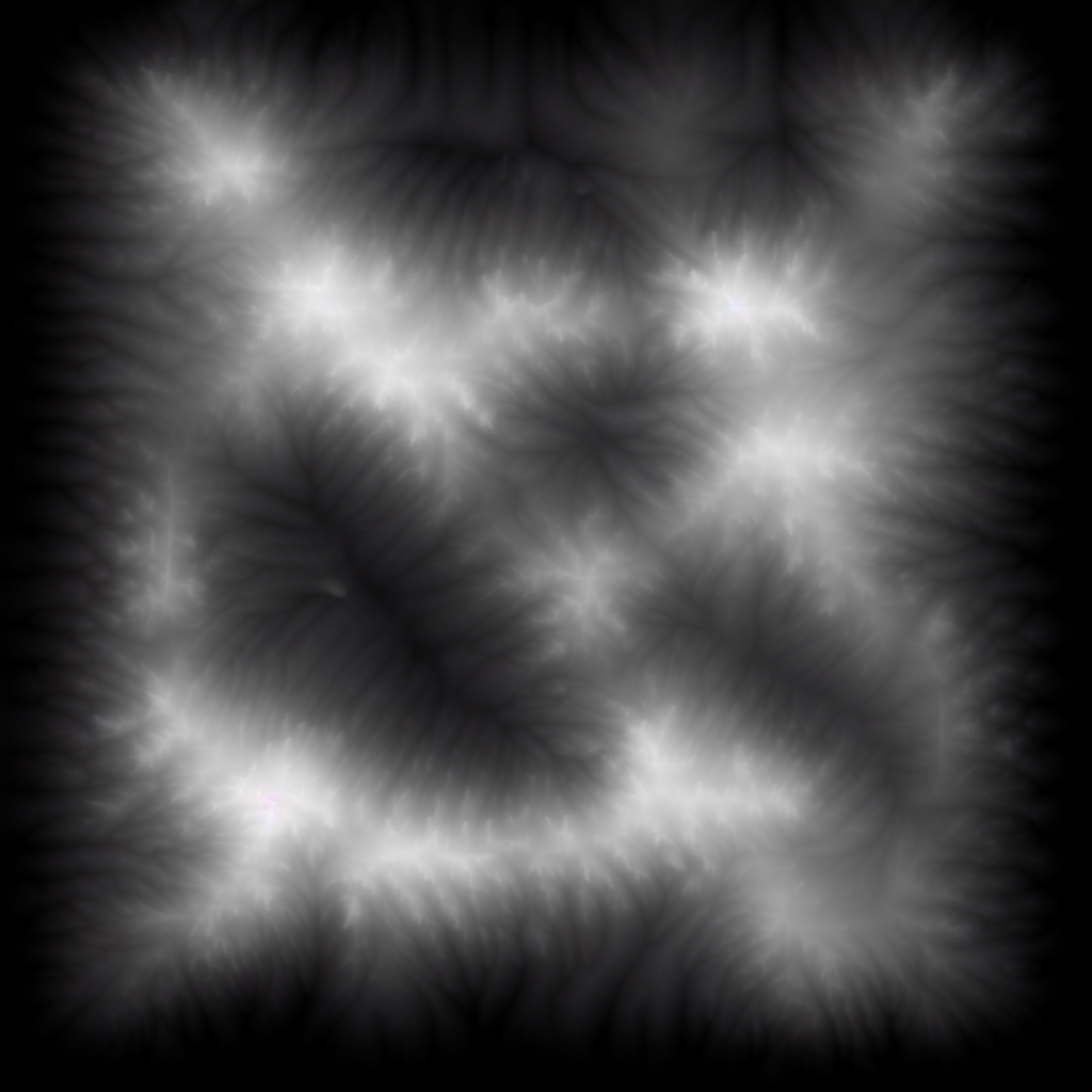
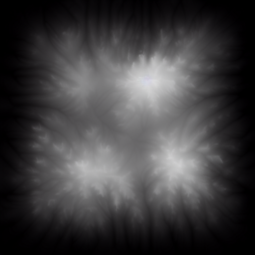
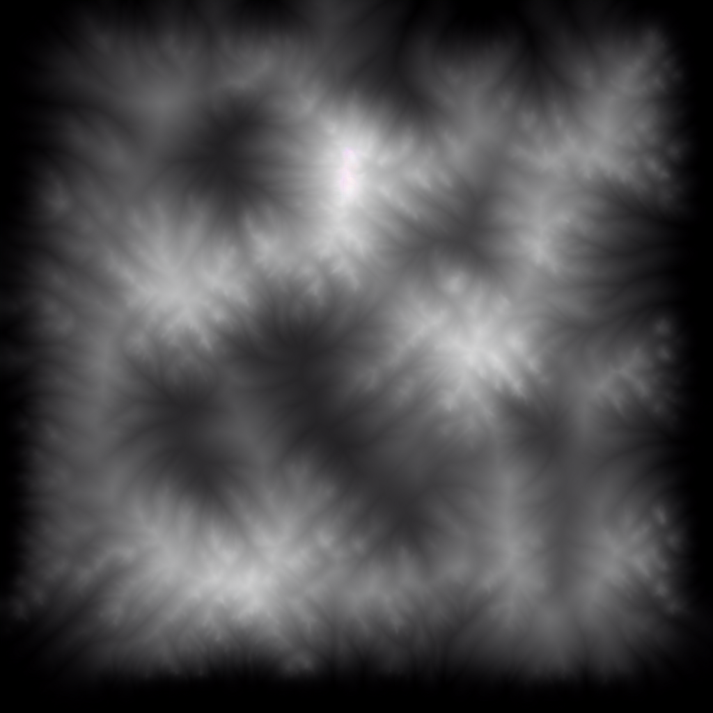
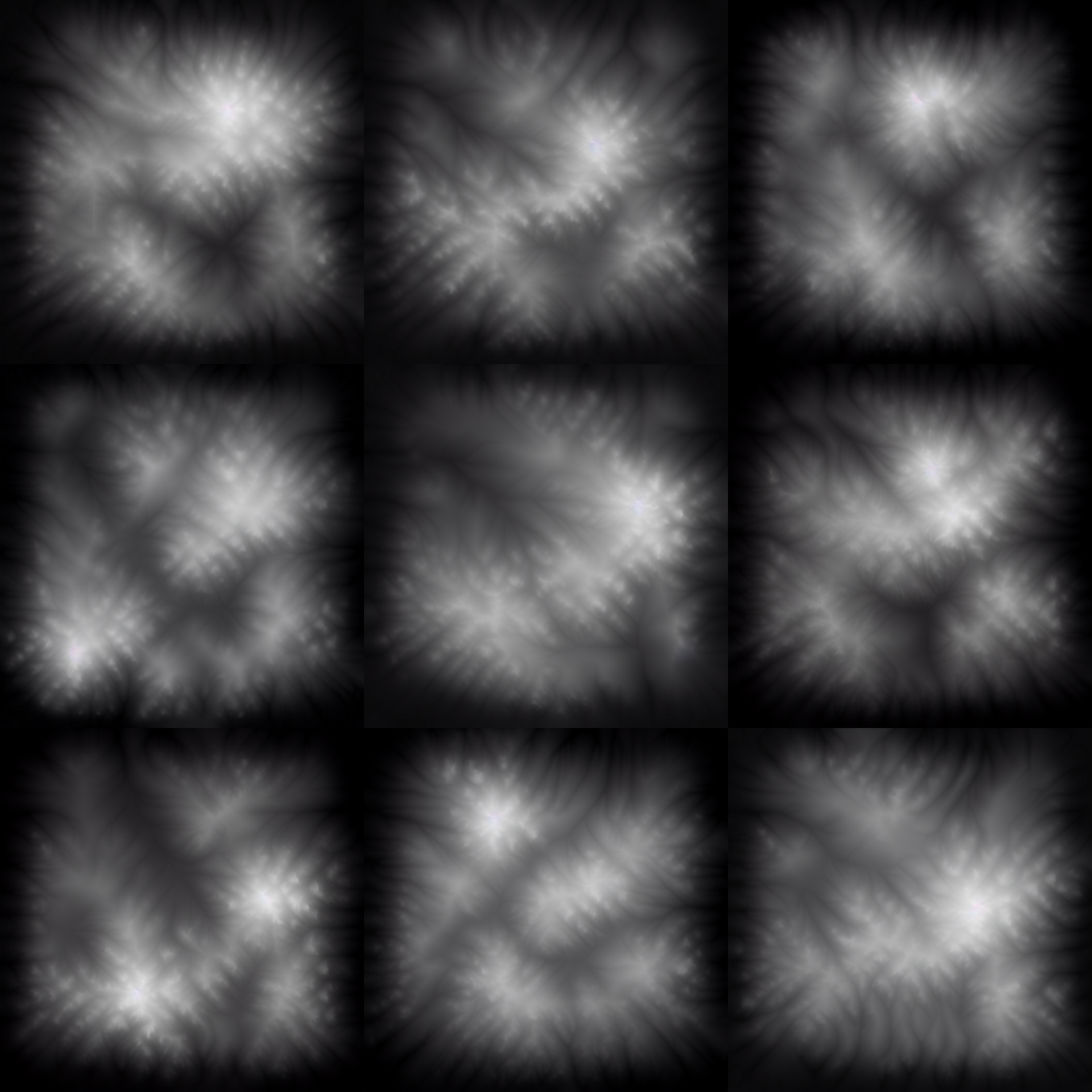
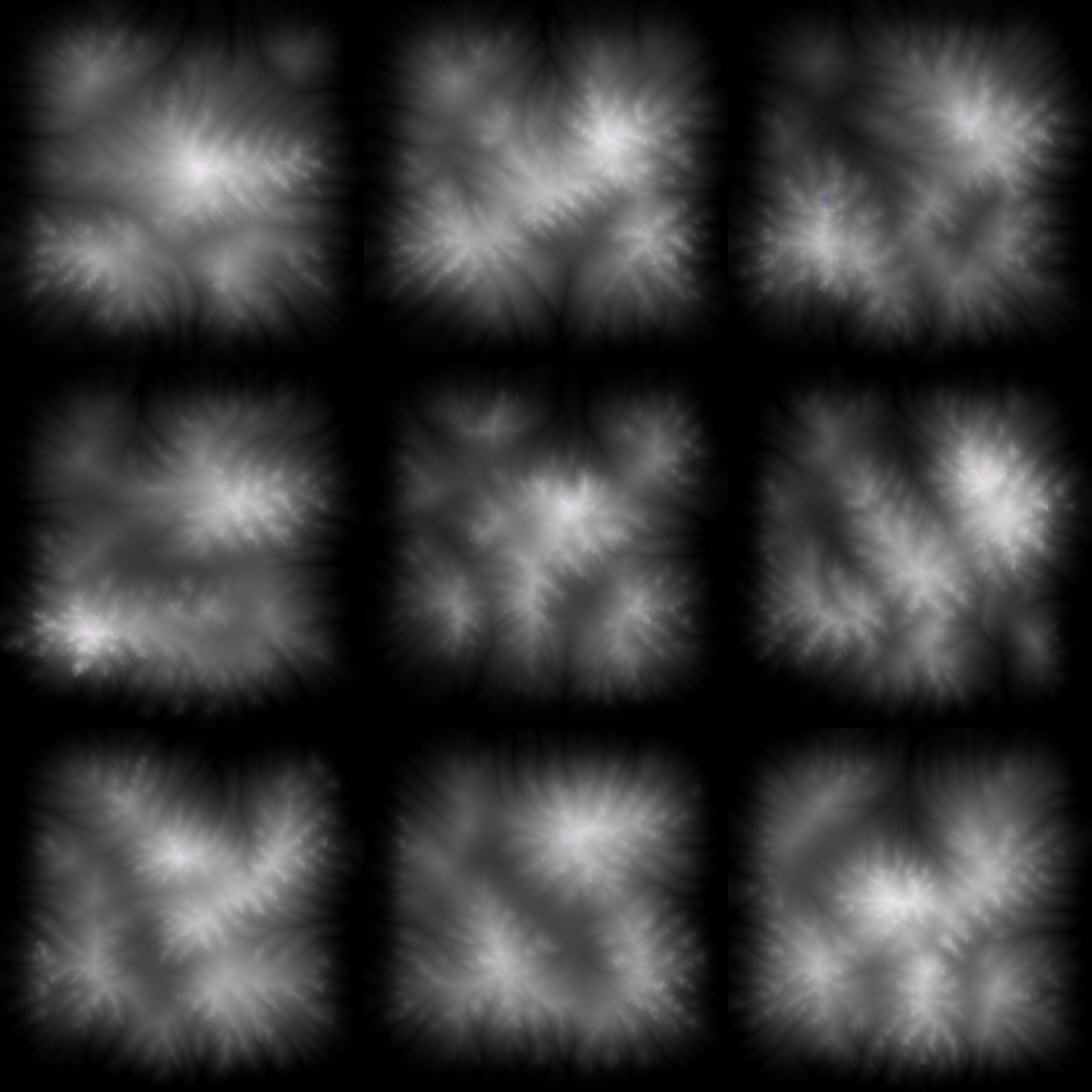
This is for you technical artists, game developers and 3D artists out there who are in need of height map data for your landscapes. This checkpoint is trained to generate greyscale height map images of landscapes, including erosion hills and mountains and mess. the output works nicely with unreal, unity and blender when you use the appropriate height that import tools to load this onto your landscape.
GameLandscapeHeightmap512 and after that, you can use the following words to compose your height map you can tell it where you want to have what type of generation happening also works with image-to-image as well as ControlNet
Alpen,
Hills,
Mesa,
Mountain,
MountainFlow,
if sufficient people find this useful I will look into adding more training data to this in order to make it a full feature-rich competitor to things like wolrd machine ;-)
link to LoRa https://civarchive.com/models/18621/game-landscape-heightmap-genrator-lora
Description
This is for you technical artists, game developers and 3D artists out there who are in need of height map data for your landscapes. This checkpoint is trained to generate greyscale height map images of landscapes, including Erosion Hills and Mountains and Mesas. The output works nicely with unreal, unity and blender when you use the appropriate height that import tools to load this onto your landscape.
GameLandscapeHeightmap512 and after that, you can use the following words to compose your height map you can tell it where you want to have what type of generation happening also works with image-to-image as well as ControlNet
Alpen,
Hills,
Mesa,
Mountain,
MountainFlow,
FAQ
Comments (15)
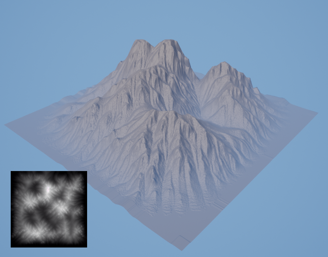
Could you add a sample of what the terrain model looks like after applying the generated heightmap?
This is a pretty interesting idea!
I added a sample image that shows how it looks in unreal 5
Is it trained on different landscapes? Can it make for example different shapes by prompt?
yes, use Alpen,
Hills,
Mesa,
Mountain,
MountainFlow,
This looks like it could be potentially useful for folks who play opensimulator (the open source version of Second Life) too. Spin up a 512x512 region, use this for terrain, load the map from the console and bob's your uncle.
Hey, do you know that this is useful besides height map? For example, to generate parameter field for numerical physics simulation.
There are stochastic tools, but I am eager to try this. Just for fun and maybe for scientific paper.
My models (real-world applied) typically have grids around 300x300 cells, so SD resolution is more than enough
Oh wow, was just thinking of training something like this myself. It would be great to have craters, canyons and other sunken features available.
You can use image-to-image for all of that, just drawing back and white something blurry and then throwing it together with the right trigger words into an image-to-image.
as mentioned, the first iteration, the next version is probably going to include a large set of different erosion types to trigger as well as more topographical shaping of the output by words.
any chance of a lora?
yes I look in to that
Impressive. How many images did you use for training?
This is great work! I was looking for something similar and it turned out that this is the only model of this type. I want to try to do something like this (or continue training this model). Can you tell me how you did it? How many images are used? Have you described each image (here is a mountain in the north and a hill in the south)?
I'm also interested
Very nice. This makes for a novel way to make generated maps at runtime using SD API and the game engine's HTTP request, and good for 2D or 3D. A max(a,b) like shader filter should blend maps together and get rid of seams quickly if you want to make a batch and put them together in any orientation. That's also a Lighten in Photoshop layer filter for manual making.
Details
Files
Available On (1 platform)
Same model published on other platforms. May have additional downloads or version variants.