

I love old maps. Maybe it's the artistic qualities, maybe it's the history, or maybe it's just because I spent a good amount of my childhood playing Dungeons and Dragons—but old and highly detailed maps fascinated me. So, I decided to bring some of that nostalgia to Flux with Cityscapes: Maps and Sketches. Rather than versions representing successive quality upgrades, I’ll explore a new era, medium, or style of map or urban cityscape art, training a LoRA on as many authentic examples as possible.
Baroque Cartography style (v1.2)
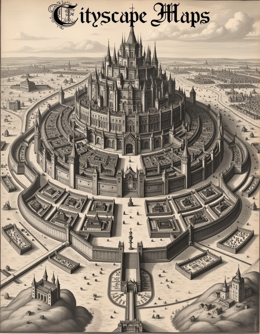
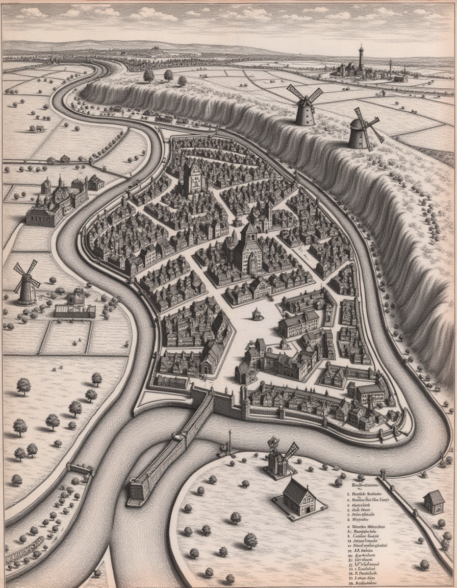
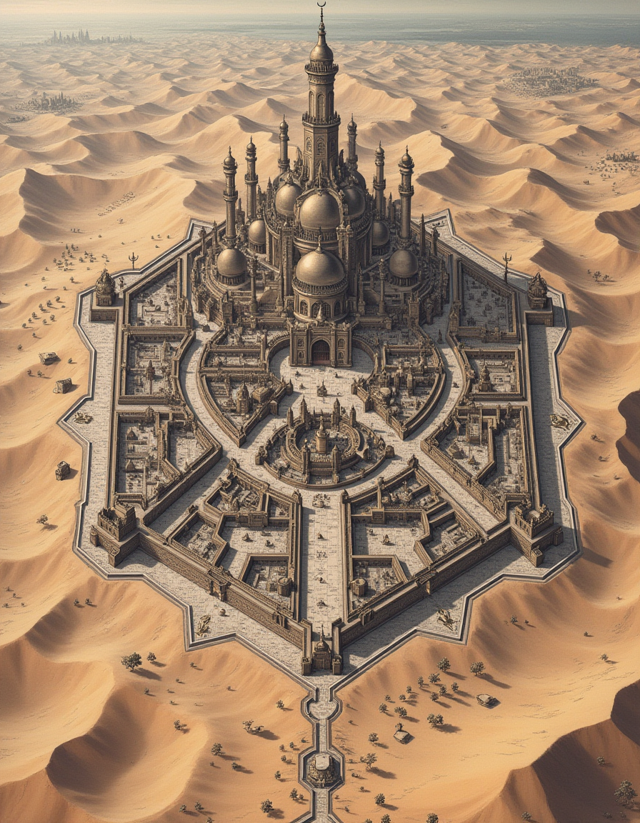
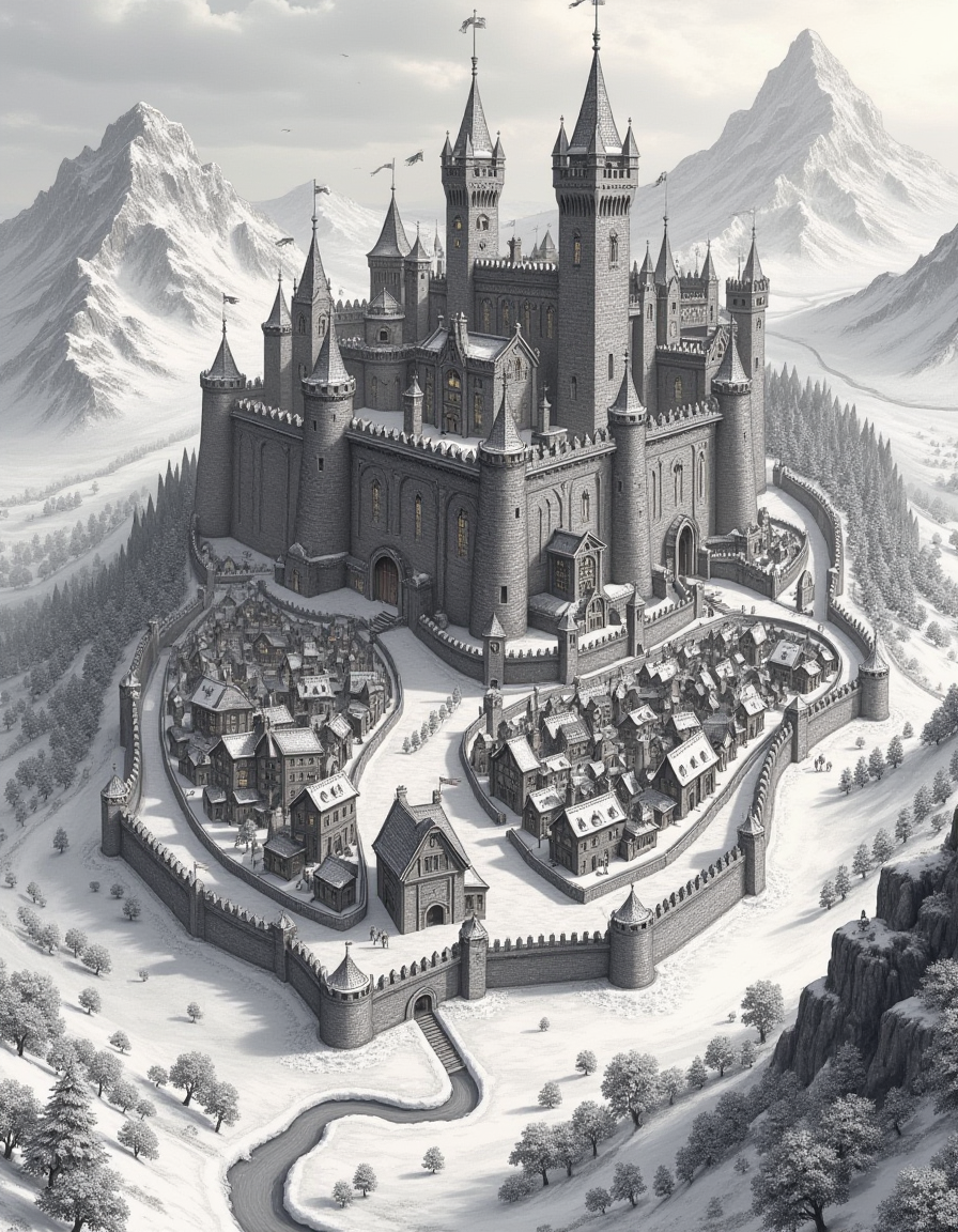
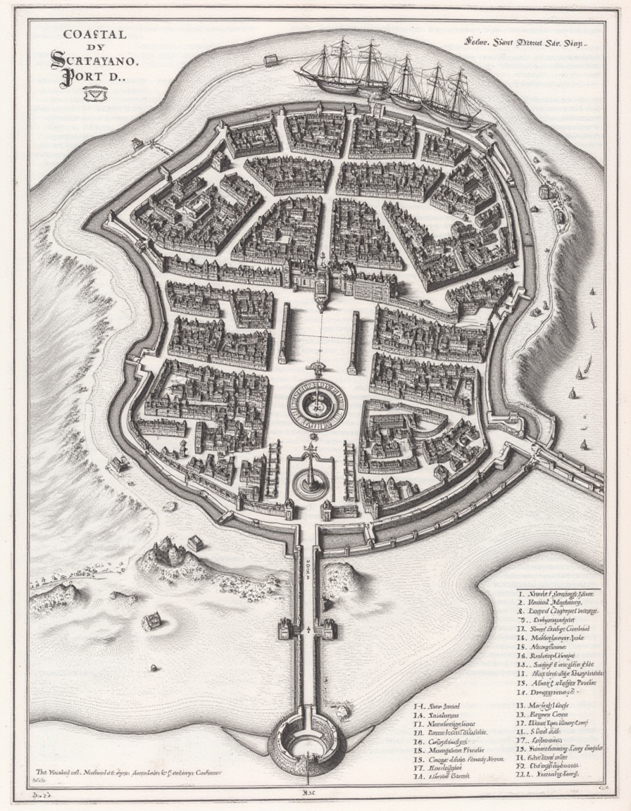
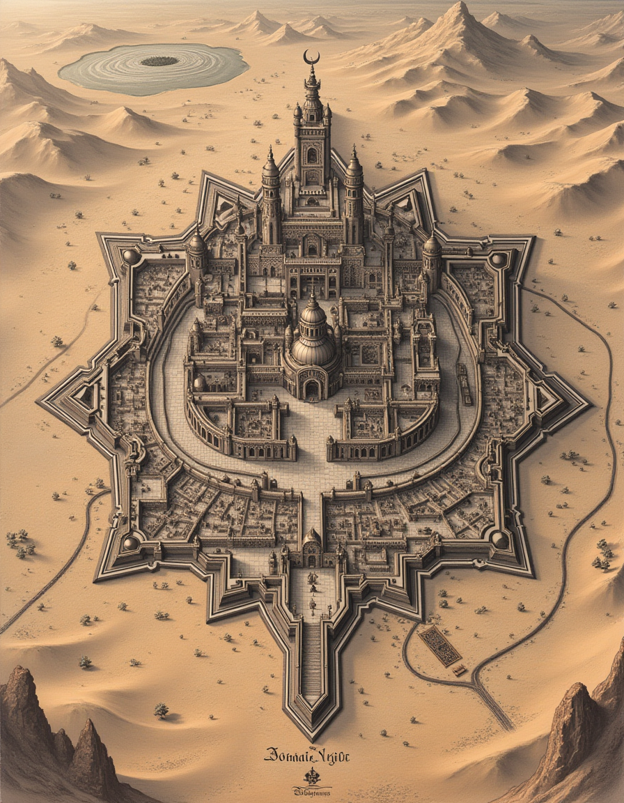
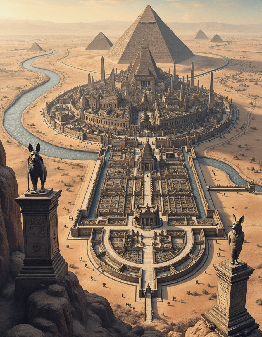
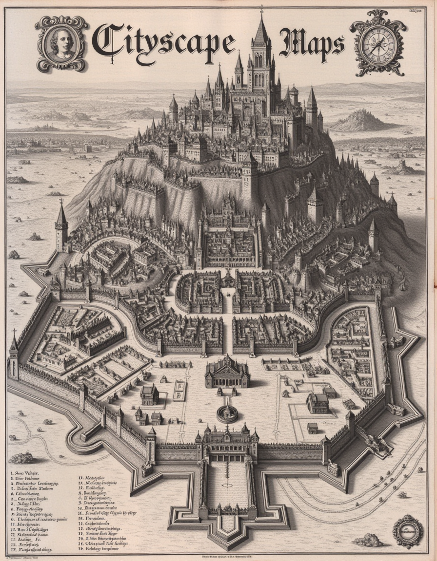
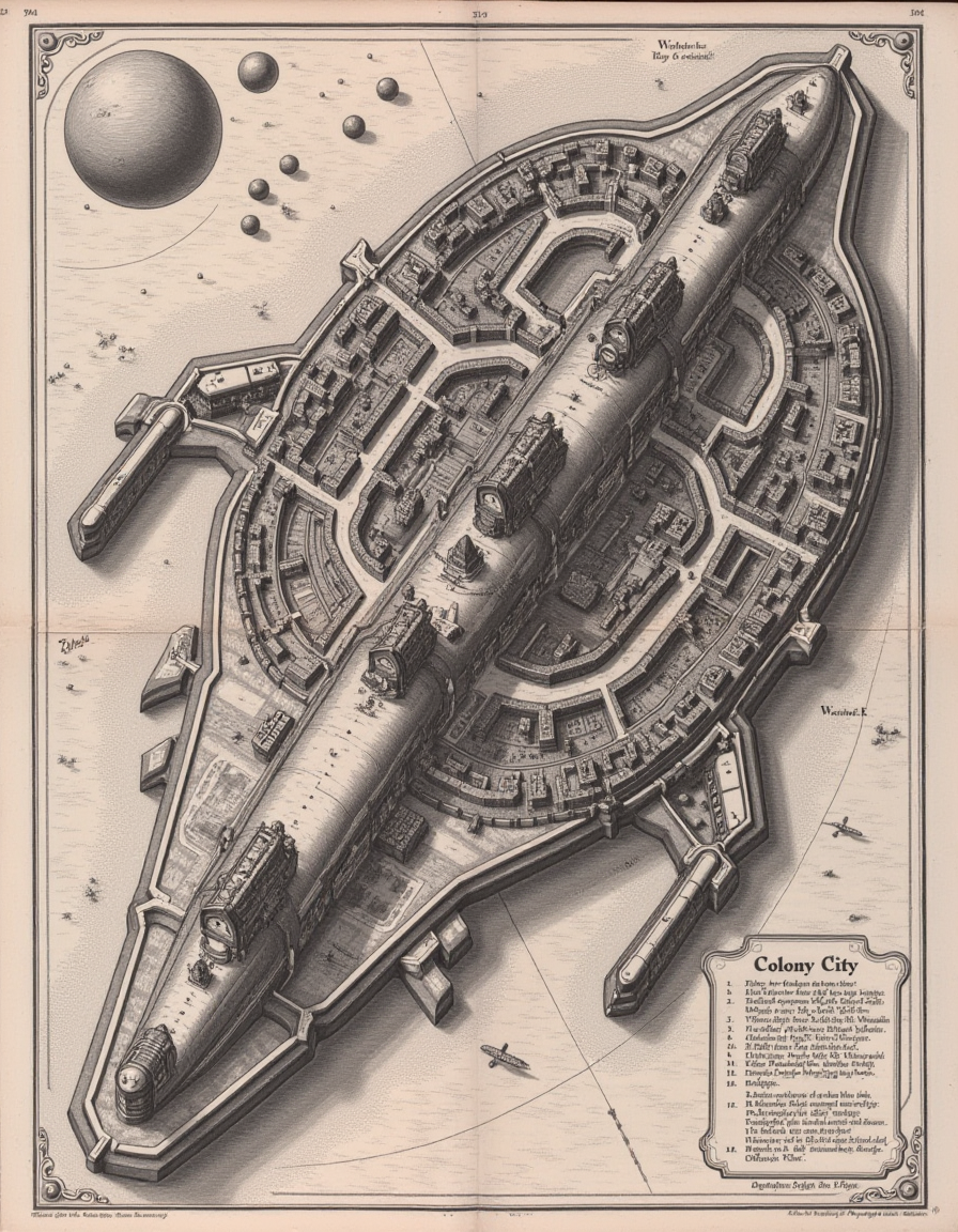
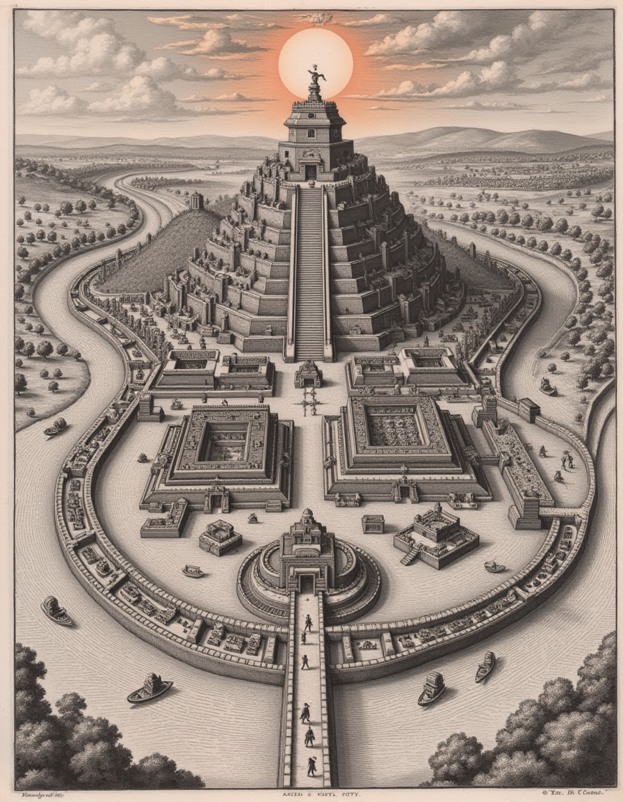
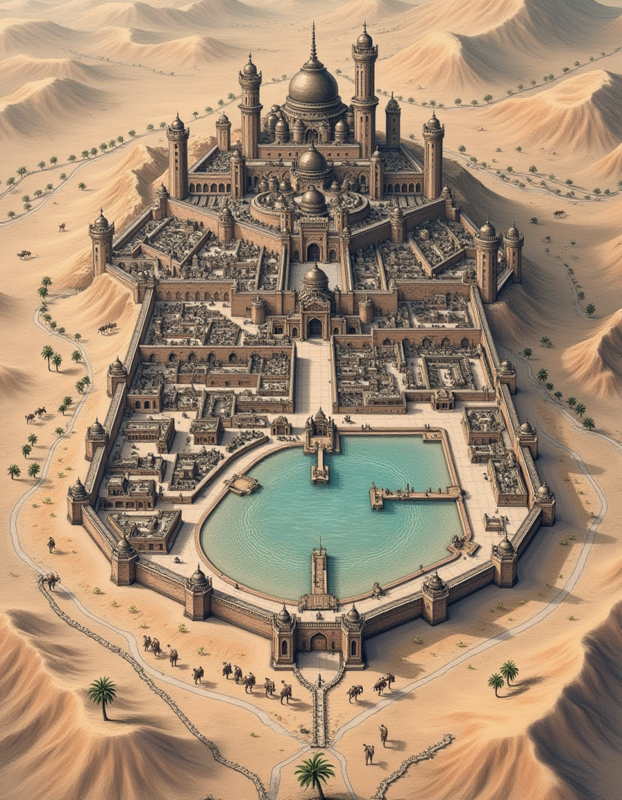
The version of Cityscapes celebrates the baroque cartography style common in the 16th and 17th centuries. These maps were as much a work of art as they were tools. The Baroque cartography cityscape style is trained on original works by the Swiss engraver Matthäus Merian the Elder. The images are from the 1600s and included in the Topographia Bavariae, Topographia Provinciarum Austriacarum, or Topographia Germaniae. Therefore, details on generated maps will reflect urban planning and design elements common in 17th-century European cities in Germany and Austria. Cities often include walls with distinct angular bastions, fortified gates, radial layouts, and defensive citadels. Most cities were surrounded by farmland, close to rivers and other waterways, and included large areas dedicated to market squares, churches, cathedrals, and administrative buildings. These elements will be more common when using this style and will be common elements used by the model if you do not give it more specific prompting.
Usage
To use the 1.2 version of the LoRA, use the following settings:
Trigger word: a dictymp map... and then describe the city.
After the trigger phrase, the model should expect the city's name, followed by its layout and features, surrounding areas, and map elements. For example: "The city of Munich. The city features narrow winding streets, a central marketplace, prominent landmarks like cathedrals, and fortified walls with gates and towers. The city is surrounded by rivers, farmland, and nearby villages. The map features a detailed legend, a coat of arms, and a compass rose."
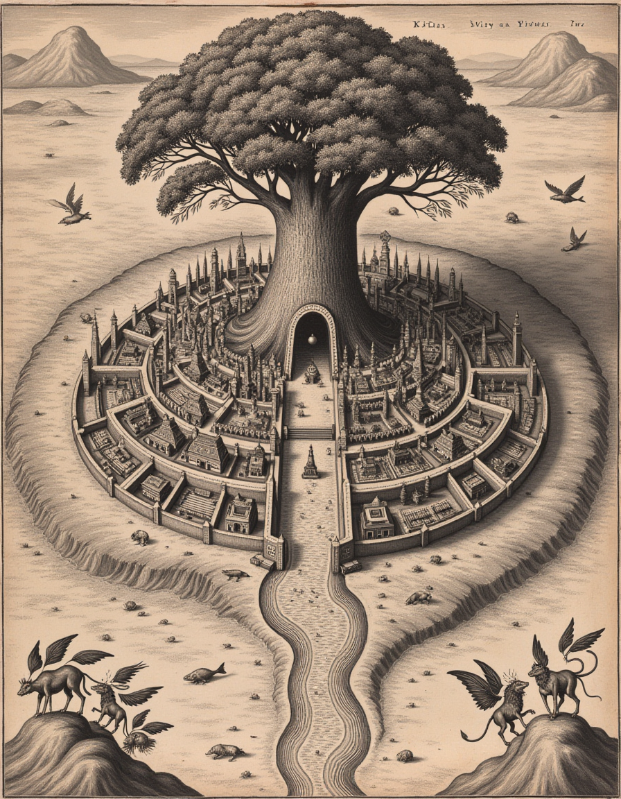
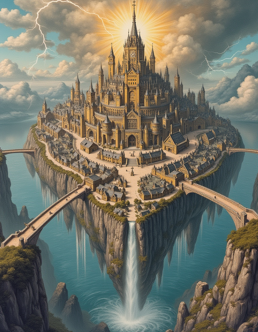
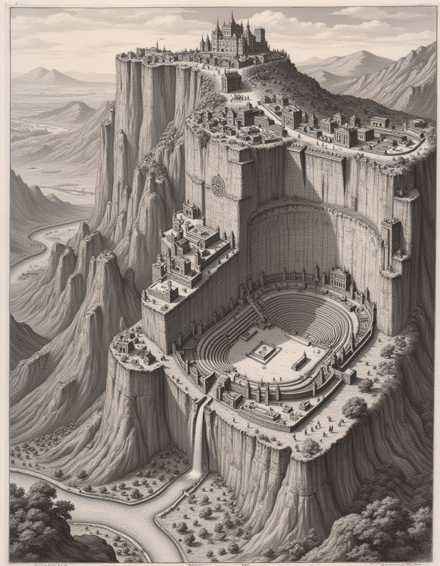
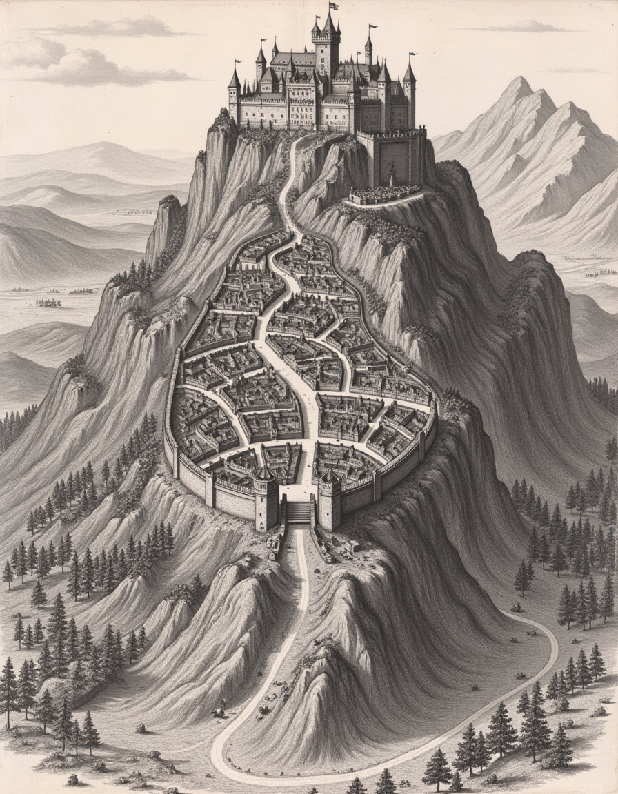
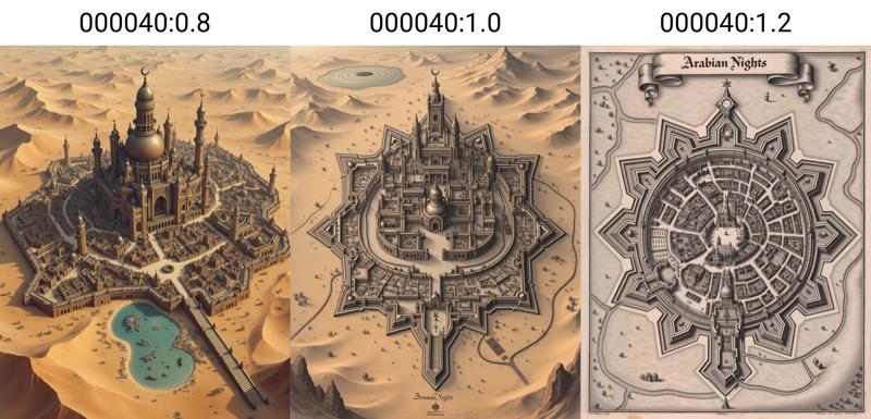
Lora Strength: Using the LoRA at full strength (1.0) will give you a high-oblique cityscape or a bird's-eye top-down map. A Higher strength (1.2) will create more monochrome 2D city planning engraving maps, while a lower strength (0.8) will produce more 3D isometric sketched maps with color. An example is included below.
Description
FAQ
Comments (17)
@chromesun and @downstream -- Thanks for the inspiration; I hope you like it.
Oops, didn't see this and left a separate comment. Downstream is looking forward to trying it in gentle fashion, and I - of course - will push it to ridiculous places 😁
@chromesun I look forward to seeing where you can take it.
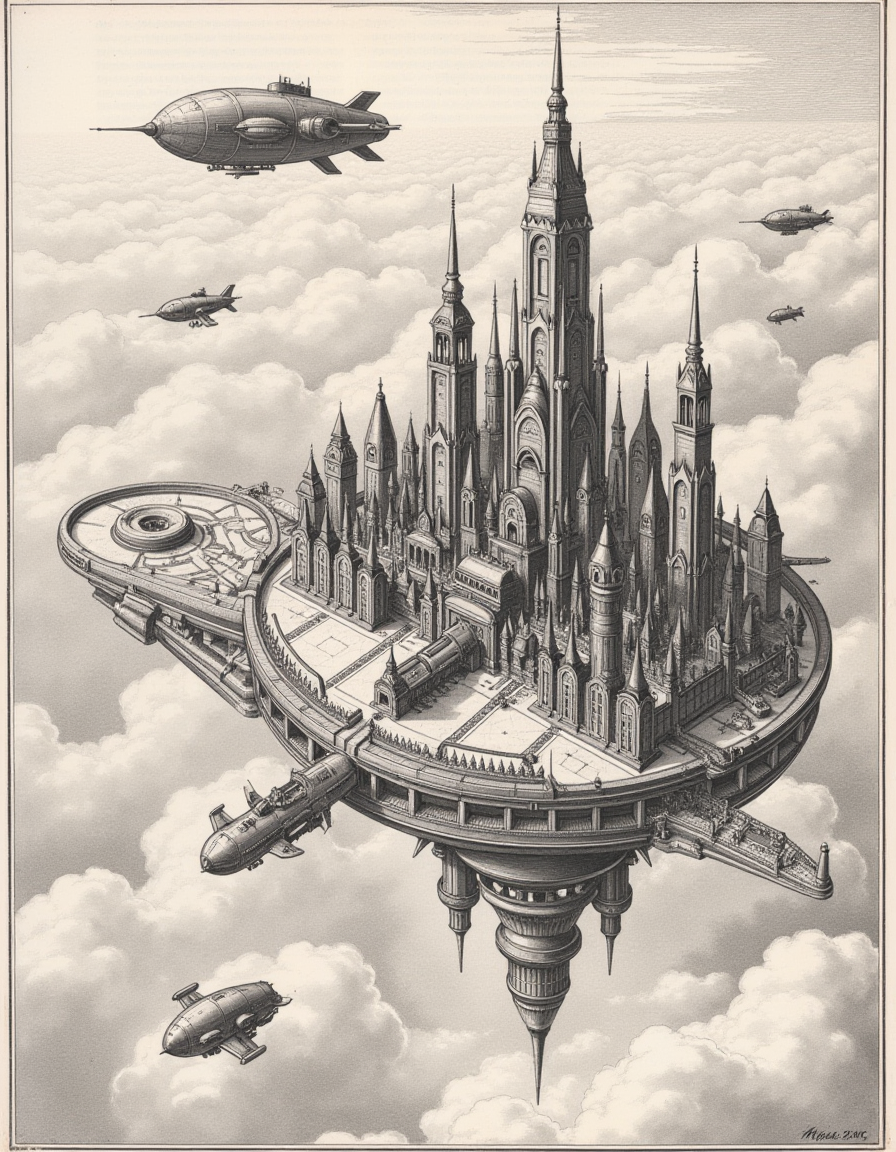
Looks fantastic. Love the domed/floating/high fantasy possibilities!
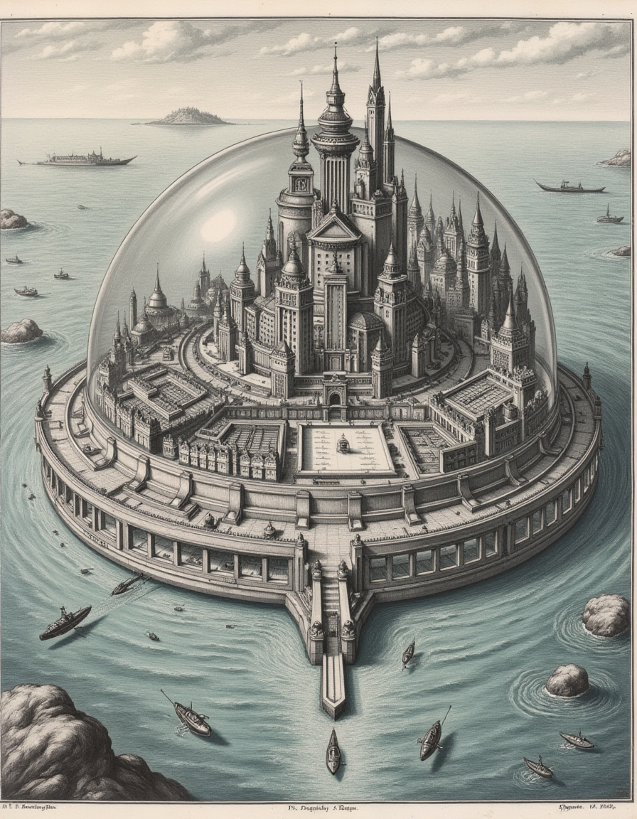
I'm amazed that Flux can generalize to the point of making some pretty fantastical cities, given that the model was only trained on a handful of historical maps of real European cities. The LoRA's flexibility turned out much better than I anticipated, and I'm pretty happy with it. I've already had a lot of fun playing with possibilities. The multi-level mountain cities have been particularly cool.
@Dark_infinity My suspicion is that Flux got fed with a lot of 3D renders. That would likely include game-like maps... which training would perhaps conflate with real world maps. I've noticed this sort of effect in other areas. Whatever the reason though, your Cityscape LoRA does a 😲😲 job! I can feel the back of my mind thinking of things to try 😁 I'll give it a go as soon as I can clear my current floral-structure task.
@chromesun I'm playing with a new version of the more floral-focused LoRAs as well. I recently stumbled onto some art by Maria Sibylla Merian. She was a German Baroque Era Naturalist Illustrator, who, funny enough, is related to the Swiss Merian engravers who made the maps I used to train Cityscapes v1. I'm building a dataset now, so I'm hoping that one will be out soon.
@Dark_infinity Sounds interesting 🙂I'm much slower I'm afraid! And out my comfort zone trying to do a photoreal LoRA for the first time. I had this idea to use my own photos (close-ups and macros) to add floral structure to things. All my recent posts with "Florate" in the prompt are tests to gauge interest. Third version seems to work but needs a weight of 2 or 3! Produces some weird scifi/fantasy scapes.
@chromesun Generally speaking, needing a higher weight means it is undertrained. Try it with a higher LR or increase the steps/epoch. I try to get mine to the point where 1.0 gets me what I'm after. That sometimes means I need to run it a few times, figure out where the convergence is happening, and then run it again with a scheduler that will slow down the learning rate a few epochs before that point.
@Dark_infinity Hmm. I'm doing this on Civitai because although I've read your excellent training guides I've not yet set up local training (3060/12 same as yours). Perhaps this is the kick in the pants I need to configure local 🙂 Could be light on training images too - only 20 and some are a bit too similar to each other.
@chromesun 20 is fine; if anything, adding images may take longer to train. If you are training on Civitai, I usually use at least a 0.00015 learning rate and 32/32 rank and alpha (at least to start). That's at batch 1. If you increase the batch size, the learning rate will need to increase by the same factor. If it's still not training well, increase the repeats or epochs to increase the training time. Or yeah, move local. Its slower, but you have more control. And a failed training doesn't hurt as bad if you didn't spend Buzz on it.
Thanks for the advice! I will look harder at the Civitai parameters... and MUST move to local. At the moment I'm treating the Buzz cost as the cost of being able to continue generating locally while training. Not long term sustainable unless I go Gold 🙄
Jawohl!
Immer zu Diensten!
WOW!
Thanks! I've loved your SDXL checkpoints!
@Dark_infinity TY!